FieldGenius for Android is data collection software that works with leading surveying industry hardware.
Vendor
Hexagon
Overview
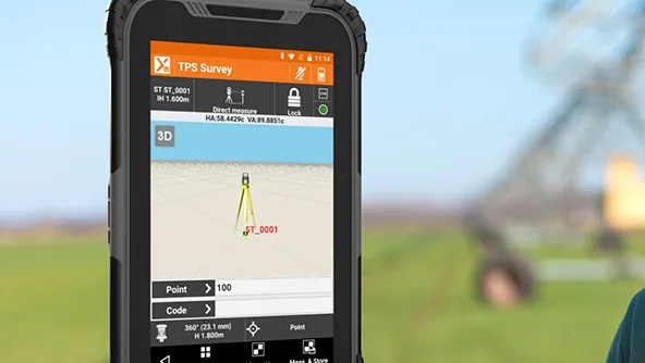
FieldGenius for Android™ is a versatile data collection software developed by MicroSurvey to enhance surveying workflows on Android devices. It offers a brand-neutral solution, supporting a wide range of hardware, including over 160 GNSS receivers and various Android devices such as phones, phablets, and tablets. This flexibility allows surveyors to utilize their preferred equipment without compatibility concerns. The software features a map-driven interface that simplifies data collection, making it intuitive and reducing the need for extensive training. Additionally, synchronized data panels provide real-time information, benefiting both experienced and new users. Leveraging decades of experience in data collection, MicroSurvey has tailored FieldGenius for Android to enhance established workflows, ensuring efficiency and consistency across different devices.
Features and Capabilities
- Hardware Compatibility: Supports over 160 GNSS receivers and various Android devices, including phones, phablets, and tablets, offering flexibility in equipment choice.
- Map-Driven Interface: Utilizes a map-driven data collection approach, making the software intuitive and reducing training time.
- Synchronized Data Panels: Provides data panels that synchronize with the map display, offering real-time information for efficient data collection.
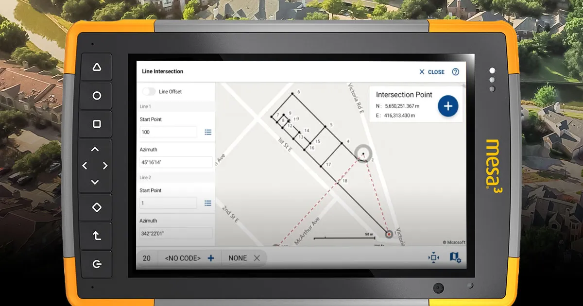
- Code-Free Linework: Enables the creation of linework without the need for coding, streamlining the surveying process.
- Integrated Help Resources: Includes built-in help resources and online training videos accessible on any device with internet access, assisting users in navigating the software effectively.
- Instrument Configuration: Offers a central location to access settings for Total Station and GPS equipment, with easy-to-use menus for straightforward configuration.
- Data Import and Export: Supports importing and exporting data in various formats, including DXF, TXT, CSV, and shapefiles, facilitating seamless data exchange.
- Custom Coordinate Systems: Allows users to define custom coordinate systems, ensuring compatibility with specific project requirements.
- Web Map Services (WMS) Access: Enables access to WMS servers, allowing users to display a variety of map background images in the map view screen, enhancing data visualization.
- Line Staking: Provides tools for line staking, including station and offset visibility in the observation toolbar, half-screen, or full-screen mode, making it easy to see staking values and relationships on the map.
- Three-Point Tilt Solution: Expands support for tilt measurements to include using a three-point solution for GNSS devices with an inclinometer, enhancing measurement accuracy.
- Project Backup and Restore: Offers project backup and restore functionality, allowing users to archive projects and restore them on another Android device, ensuring continuity in data collection.
- GNSS Driver Support: Includes support for various GNSS drivers, such as Howay P78 and CHC LT700H, broadening hardware compatibility.

fieldgenius-for-android-datasheet_2023.pdf