Leica Pegasus FIELDHexagon
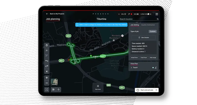
Plan and execute projects with visual and audio feedback along the route to make data collection failure a thing of the past.
Product details
Overview
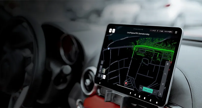
Leica Pegasus:Field is a versatile mobile mapping system designed to capture high-accuracy spatial data in real time. This solution is suitable for dynamic field environments, enabling professionals to create precise 3D models and map geospatial data efficiently. It combines advanced sensor technology, GPS, and lidar to provide comprehensive surveying and mapping capabilities, improving workflow efficiency in industries such as construction, transportation, and urban planning.
Features and Capabilities
- Advanced 3D Mapping: Combines lidar and GNSS sensors to provide highly accurate geospatial data in real time.
- Data Integration: Fusion of multiple sensor technologies ensures reliable and precise measurements.
- Field Mobility: Designed for on-site use, it is lightweight and can be easily deployed in various field conditions.
- Customizable Outputs: Offers versatile data formats for processing in different geospatial software tools.
- Intuitive Software: Simple interface for seamless data visualization, reducing time spent on processing.
- Efficient Data Management: Supports rapid storage, transfer, and processing of large datasets.
- Scalable Solution: Can be used for both small-scale projects and large, complex mapping tasks.
Documents

Leica Pegasus-TRK100-DS-982592-0424-en.pdf
Find more products by industry
ConstructionUtilitiesMining & QuarryingManufacturingTransport & StorageView all